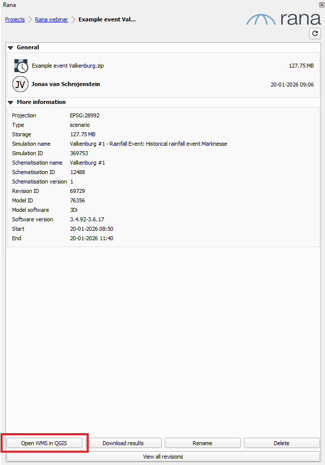
Load results as WMS layers
You can add the post-processed results from Rana to your project as WMS layers, such as maximum water depth maps. This has several advantages: you do not need to download anything, and you can easily view the water depth map for any time step, or see how the water depth map changes over time.
You access the WMS Layers via the detail page of a scenario.